Wednesday, June 26, 2019

Day 39 - Santa Sofia to Bagno di Romagna


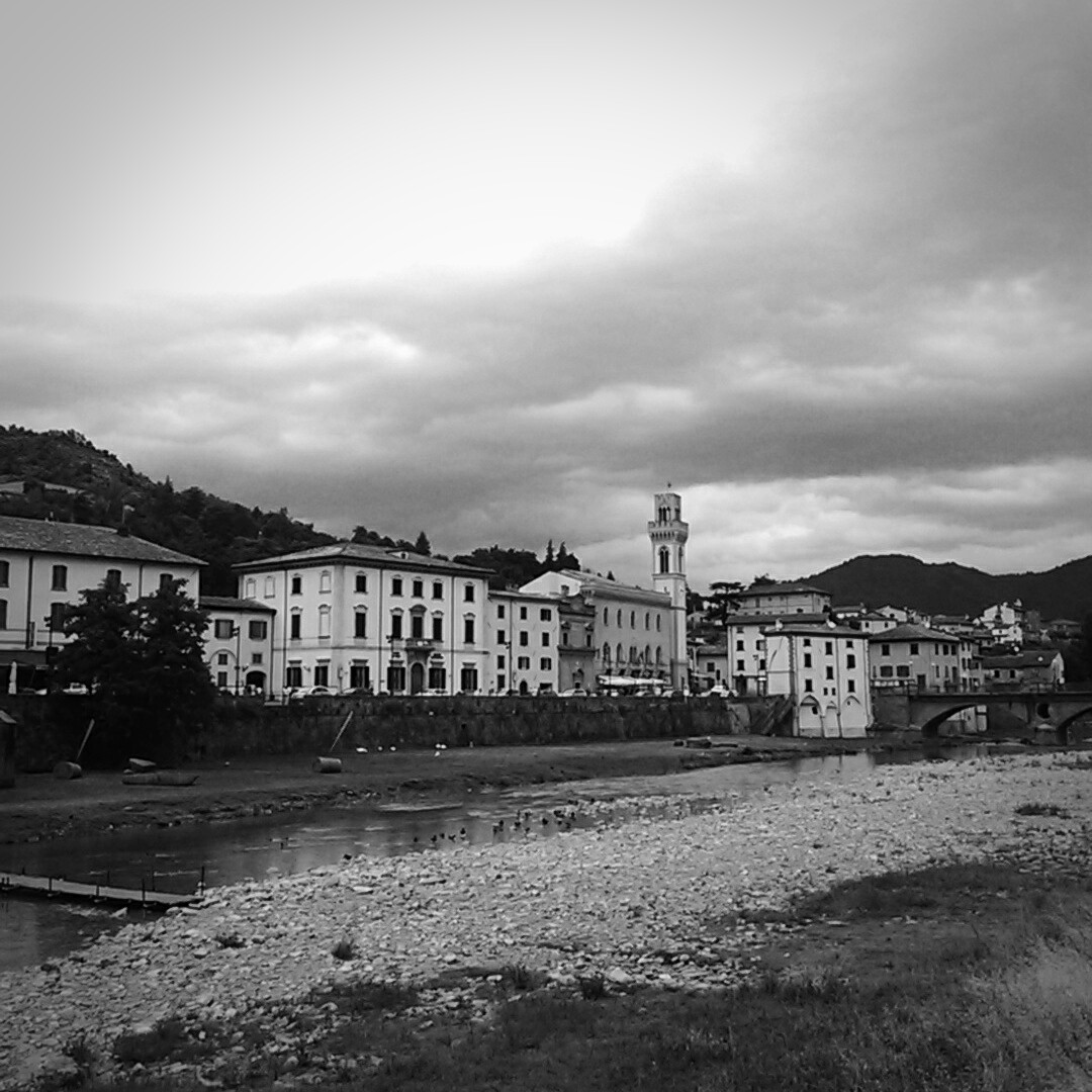
Thunderstorms did their work through the night, dropping intermittent deluges of water upon Santa Sofia. When we awoke, the air was cool (around 55 F) but humid (97%). Clouds still covered most of the sky, and wisps of vapor rose from the mountain slopes that encircled the town.


This and the next day have been in the back of our minds since the earliest stages of planning this trip. Between Santa Sofia and La Verna, we must climb 2,280 meters. This is more than a mile of elevation gain over a two day period. Every day these two stage, which the guidebook labels “difficult” had been growing closer. Now the hard physical test was at hand.

I loaded four bottles of water and two bottles of Gatorade (a total of 3 liters of liquid) into my backpack. I didn’t know if there would be opportunities to refill, and I didn’t want us to run out of water.


We began our climb on a road that led out of Santa Sofia. All went well until we reached a spot that our guidebook refers to as the “Localita Raggio.” Here a gravel road departed from the peaceful road we had been ascending. We followed the sign. The gravel road quickly ran out, and we found ourselves standing at the bottom of a farmer’s field. A distant sign guided us across the crops. We followed a faint trail across the field, but when we reached the top, the field ended and we entered an uncultivated wasteland, filled with tall grass and friable soil that collapsed underfoot.


Since the thunderstorms had soaked the area overnight, the grass (which rose over my waist) was soaked. My shorts and shoes quickly began to mop up all that excess liquid. The signs that had guided us to this point vanished, all the  grassy indentations that might have been a trail had vanished, and we were simply out standing in an overgrown field.


On the Path Less Taken


I brought out the GPS and was able to navigate a course up the untracked hills, following what the GPS thought was the trail. Eventually, after fighting through an increasing number of blackberry brambles and thorny wild roses, we came to a place beneath a small wooden structure. It had two Via arrows on it, pointing to the right. Beyond the structure was a two rut gravel road. The only problem is that a right turn did not seem correct. It led down the hill in the wrong direction. The right turn appeared to lead to a herd of brown cows that were watching us with supreme interest. A left turn (according to the GPS) would eventually bring us to a gravel road and might get us where we wanted to go.


The Waymark Led to Cows


Stupidly, we followed the waymarks. We walked downhill and walked past the cows. The road ended. We decided to walk along the edge of the field paralleling the original course I had in my GPS. Our shoes, which were now encased in burrs, tangle weed, and grass seed, became even wetter (I wouldn’t have thought that was possible).


We ran out of farmer’s field, and found ourselves hedged in by a dense thicket of trees and blackberry brambles. My frustration was mounting. According to the GPS, the road we wanted was on the other side of the impenetrable thicket. We worked our way down the thicket until I finally found a narrow break between the trees. Hacking away at the brambles with our hiking poles, we cleared a path to the road.


Then the horse flies attacked.


Here’s a tip for those contemplating this walk: when you reach the Localita Raggio, stay on the main road! Both routes, the road and the bushwhacking fight through blackberry vines and unmarked trails reach the exact same place. If you opt for the wilderness experience, make certain you have a GPS, or abandon all hope, ye who enter these fields. The search parties will find you weeks later, wrapped in a cocoon of tangleweed and blackberry vines.


We managed to get back on course on the nice asphalt road (and whoever would have expected me to write those words). After a short respite we turned off onto a gravel road that began in a pleasant manner, but as we climbed, the gravel turned to dirt, and the dirt (remember the thunderstorms) turned to mud. Soon we were slipping and sliding, clawing for traction. We walked on what felt like platform shoes. At one point I had at least an inch of thick mud, straw, and tangleweed clinging to the soles of my shoes.


Slogging through the Mud


On the positive side, my indignation was driving me up the hills.


We finally reached the main road (blessed asphalt) again. We found a small park near a closed restaurant and sat down for a few minutes to take stock of our situation. I changed my socks, and winced as the fresh pair began to soak up more water from my sopping shoes.


The road continued to climb. Ultimately, we topped out at 803 meters (according to the GPS). The views, looking up and down the valley were fantastic. Mary and I both agreed that even with the trail follies we had endured, it was still far better than the long, flat, straight days that still haunted our memories.


We began a small descent and then reached Gamberini, where there is a small bar favored by motorcyclists, bicyclists, and Via hikers. Mary had a bag of potato chips and I cooled my throat with a prosecco. I cannot recommend Gamberini enough. It comes at a perfect point in the stage.


Refreshed and revivified, we were ready for the second half of the stage. Once again the Via departed from the lovely asphalt road and set off through farmer’s fields and woodlands. Rather than driving right for the next town, San Piero in Bagno, the hiker route makes a long loop to the east of town. It follows some paths that were pleasant, and others that really need someone with a machete to trim back the blackberry vines and stinging nettles. Our lower legs were taking a thrashing. Mary claimed that it was penitential, like a flagellant. We will be well beaten by the time we reach La Verna.


The goal of this path was the Eremo di Corzano, an ancient hermitage on the top of a small mountain overlooking San Piero in Bagno. After a final climb, we reached the site, where we could see a couple of stone walls of the hermitage.


Eremo di Corzano


Down the hill from the hermitage was a pretty little church, Il Santuario della Madonna di Corzano. According to the story, a local cult of Mary had sprung up here, and in 1835, when an earthquake struck nearby San Piero, the people pleaded for her intervention. The earthquake stopped, and the grateful people built a sanctuary at the top of the hill overlooking the city, where an old fort had been.


Madonna di Corzano


We had a quick look into the church, but time was pressing. We made an agonizing walk down the old muleteer’s path, that connects the church to the city below. This is a steep path that is made of carefully laid stone and concrete. It is difficult to walk on and agonizing on overstressed feet. We gingerly descended to town.


Mary Descending the Mule Path


San Piero in Bagno looks very interesting. It was a pity that we did not have the time or energy for a look around. We shall put it on our list of future places to visit.


The last stage of the day was a hike along a busy road. We were on the bike path. We followed it into Bagno di Romagna. On first glance, this looks like a very touristy city. It is home to thermal hot springs and bath houses. I suspect many people come here for the waters, and when they aren’t soaking their cares away, they drift among the high end shops that crowd the main street. We didn’t linger, but found our hotel. After eight hours on the trail, one of our longest days yet, we were beat.


Tomorrow an even more arduous climb to La Verna.


Today's Distance: 27.4 KM

Total Distance: 711.9 KM

Day 38 - Civitella di Romagna to Santa Sofia


We awoke in the morning to the liquid rhythm of rain upon our roof. We had spent a very uncomfortable night in a tiny room that lacked air conditioning and was placed right beneath this old, stone farm house's roof. It was a sweat lodge. Even with the window open (an invitation to every mosquito in Emilia-Romagna) the temperature was still in the upper-eighties. We tossed and turned and sweated through the night.


Then, with the dawn, rain.


Rain is my favorite weather. Nevertheless, I could not help remember how unpleasant it had been to hike in the rain at the beginning of this trip. Wet socks, blisters, sliding around on exposed tree roots and shale. Wasn't there some happy medium between the weather extremes? How about a 55F day with thick clouds to blot out the sun?


In any case, you don't get to pick your weather on the Via. When it's skin-blistering hot, you hike. When rain descends in a Genesis deluge and lightning spiders around the distant peaks, you hike.


It was not raining when we left town. Because we had divided up the stage, we had a fairly short 14 kilometers to our destination. It was about 25 degrees cooler than it had been the day before, but it was still very humid.


Our route still followed the river. After winding up and down a couple of hills, we reached a point where the river had carved a path through the limestone. This mini canyon directed a flow of cool air into our faces which was very refreshing.


Stone Canyon


The canyon was also home to a couple of horse ranches. Paddocks stretched away from the water and dozens of horses munched on nasty looking piles of hay.


The Wild West


As we approached our first town, Galeata, we passed a number of cherry trees lining the road. They were a dark red, succulently ripe. I popped a couple in my mouth. Mary picked a couple and said, “I think the signs say that they want people to eat them.”


Signs? I hadn’t seen any signs.


She pointed out a thin red and white banner hidden beneath the leafy branches. It read, ciliegie avvelenate. “That means ‘eat the cherries,’ right?”


It was a new word for me. I looked it up quickly: poisoned, toxic.


We quickly spit out our cherries. I assumed that the sign meant that they had been sprayed at some point in the past. If they really were poisonous cherries, more visible signage would be a good idea.


Galeata


We entered Galeata. The streets were full of people engaged in Saturday morning socializing. At the far end of town we passed a natural water machine where you could fill your plastic water bottles with natural, lightly fizzy, or full fizz mineral water. Five euro cents per liter. I needed something to counteract the effects of poisonous cherries, so I filled two bottles with frizzante.


Further down the road was Pianetto, a lovely little burg. We did not see as much of it as we would have liked, as the Via turned in the middle of the town and went storming up a hill, a route that was supposed to lead to the ruins of a castle. Unfortunately, at the foot of the hill upon which the castle was located, an electric fence prevented further progress. We followed a road that flanked the hill, and emerged at a signboard describing the castle. Once again, an active electric fence blocked entry into the site. We stomped around a dairy located near the castle, looking for the way back onto the trail --- this would be a fantastic place for a few waymarks. Ultimately, with the help of the GPS, we were able to get back onto course, slipping down a cow trail, through muddy feces.


As we closed on Santa Sofia, we passed through a series of empty and vine-encrusted houses. It was an abandoned village, once called Qualtrosola. I don’t know why these homes were abandoned, but today the crumbling buildings are slowly being overtaken by the elements.


Qualtrosola


Down the hill, through a farmer’s field, and then on to Santa Sofia. The sky had clouded over and thunder was rolling across the line of mountains ahead. As we passed through the outskirts of town, rain began to spatter, and then quickly thickened. We jumped under the overhang of a building in the cemetery and strapped on our backpack covers.


Naturally, once our backpacks were secured, the rain stopped. We continued on into Santa Sofia, found our delightful accommodations, and settled in for a rainy night.


Santa Sofia


Today’s Distance: 14.5 KM

Total Distance: 684.5 KM

Saturday, June 22, 2019

Day 37 - Meldola to Civitella di Romagna


We departed at 8:00 AM. The high temperature yesterday was 97 F, and we wanted to ensure that we put as many kilometers behind us as possible before the sun really began to bear down. The streets of Meldola were fairly lively this morning; people were out running their morning errands and going to work. I began to think about the fact that Italians orient their days around the daily temperature cycle. One does some business in the morning while it is still cool. Then, in the late morning through the afternoon, you lay low in the shadows of your home, When evening comes and the heat abates, it is time to emerge and walk around the town. It is a very sensible system. Only people like us, who must rack up the kilometers, are crazy enough to walk in the noon-day heat.


After leaving town, we plunged into a mixture of farms and forest. Today’s route loosely tracked the Fiume Bidente (Bidente river). I imagine that the river is responsible for the alluvial flood plain that fills the valley we were ascending.


Fisherman, Fiume Bidente


Here is a note for future walkers: after coming off the first bridge over the river, make certain that you take the first right hand turn that presents itself. There is a waymark (placed high in a tree), but if you do not see it when you pass (as we didn’t) then you will find yourself continuing on the asphalt road that leads up a steep slope to Castelnuovo. This would be unfortunate, as it is definitely not the right way to go.


Once we found the right path, it was a very pleasant walk. We strolled through a shady grove beside the river. Birdsong erupted all around us and the slow-moving water of the river was very peaceful.


As we continued up the valley, I noted that the ridges that contained us were growing higher and wilder. Each step bore us closer to Italy’s spine, the Apennine mountains.


The peaks grow higher


At one point, the route ventured out onto the busy statale. In Gualdo, just before we joined this highway, we found a small park with a bench under a shady tree. Not only that, but there was also a fountain to refill our water bottles with cold mountain water.


Lovely.


We hiked 1.2 kilometers along the highway, which, despite the fact that the cars were moving at a very fast clip, felt much safer because there was a nice shoulder that we could walk on. It certainly felt a lot safer than it did yesterday on the shared bike path.


As we approached Cusercoli, we saw what appeared to be a large monastery filling the skyline. It turned out to be an ancient medieval fort/castle. There did not seem to be any obvious way to visit the castle, so we passed through the town, admiring its stonework and narrow medieval roads.


Castle at Cusercoli


The day had gone very smoothly. We had logged about 13 kilometers and were looking forward to ending our day’s trek.


The Via had other plans for us. The path now turned toward the growing ridgeline to our right. We passed a small lumber mill and then began to ascend the side of a peak. To compress a difficult passage into a few sentences: it was arduous. After a couple of weeks on the flat land, the sudden ascents and descents on shale-crabbed dirt paths were taxing. Up and down. Up and down. Gain fifty meters and then give it right back again.


Mary in Wheat


We were very happy to make our final descent from the slopes and see Civitella glistening in the distance. We hiked into town, and on the outskirts, found a small roadside piadina (sandwich) shop. I had a mushroom and cheese piadina, and drank a liter of ice tea and a half liter of water just to get it down. I was incredibly thirsty.


We continued into Civitella. It is a beautiful little town, with gorgeous architecture and a delightful central piazza. On the outskirts of town we discovered the Santuario della Beata Vergine della Suasia (The Sanctuary of the Blessed Virgin of Persuasion). The large, domed basilica was erected on this spot after Mary appeared to an orphan in 1556. It was a lovely building, although I had the impression it might be badly in need of restoration.


Santuario


In any event, we reached our destination and stood down for the evening. Tomorrow will be a short (but steep) stage, and after that, two of the most difficult days in the entire trip as we cross over the mountains to La Verna.


Today’s Distance:23.8

Total Distance:670


Friday, June 21, 2019

Day 36 - Ronco to Meldola


Today was scheduled to be a shorter day (we have divided the next two guidebook stages into three), so we were in no great hurry to leave our odd little hotel. At 8:30, we loaded our gear and set out the door. We retraced the previous night’s route and near the Ronco church, we departed from the busy road that bisects the town. The road turned into a grassy path, and once more we found ourselves back up on a levee. I'm beginning to wonder if we will be on levees the rest of the way to Rome.


We had a difficult time last night finding a place to eat. The nearby restaurants were (mysteriously) closed on a Wednesday night, and the only option that was close enough to hobble to was a sandwich shop that served American cuisine. I don’t normally eat beef, but I felt compelled to try their steak and mushroom sandwich. It was very large and quite nice. I liked the mushrooms and melted cheese.


I suspect that the steak went right to my feet. They felt very good as we hiked through the woods, pain-free and as peppy as a Dallas Cowboys cheerleader. I danced happily along for the first several kilometers. Perhaps I need more steak in my diet.


The first half of today’s stage was amazingly pleasant. We walked on soft ground through dark groves or beside large shade trees. We had little direct exposure to the sun. At one point we passed an immense field of dill. This farm was so large that it could have probably supplied the entire world with dill.


As we hiked, I found myself hoping that we had made our escape from the central stages of the Via. Today’s stage was the second of a six day sequence of stages which will carry us over the Apennine mountains to the Franciscan monastery at La Verna. Although it is never easy to climb over mountain ranges, I have set my mind on the idea that it will be cooler at the higher altitudes, and there will be shady forests and soft paths for our feet.


A Soft Path


If the first half of this stage was indicative, then everything would be fine. We were shielded from the soul-sapping sun, and strolled through bamboo thickets, passing wild cherry and apple trees.


A Bamboo Thicket


The path turned back to asphalt in the second half of the stage. We were set back out on the roads, and although they might have been a little quieter than earlier stages, we still experienced at least one near miss with an auto.


Coming through the forests, it was difficult to see how the land around us was changing. When we emerged, we saw that we were among rolling hills covered with vineyards. “It all seems so pretty again,” said Mary.


I had to agree.


Around the 10 KM mark, we approached the small town of Fratta Terme. This seemed like a good point for a break, and we looked forward to finding a bar as we passed through the town. We were disappointed, therefore, when the waymarks and book led us up through a vineyard, around the eastern side of the town. The walking route bypasses the town, while the recommended route for bicyclists rolls right through the center.


I am going to give up second-guessing the routing of the Via. Here is my recommendation: follow the bike route and go through town. Take a break at a bar.


We didn’t. I wish we had.


We returned to the main road, south of Fratta Terme. We still needed a place to take a break. I spotted a small white church and suggested to Mary that we sit on the steps in front of it.


Church at Fratta Terme


As we approached, we were pleased to see that the door stood wide open. It was a very small church: I counted six pews and about a dozen chairs. Apart from the obligatory Mary and Jesus statue in a niche on the right-hand side, the church was undecorated, spartan. We shrugged off our backpacks, took seats in the last row of chairs, and unlaced our shoes. I worried that someone might come along and throw us out --- we were, after all, taking a break in a house of worship. But then I had a different thought: a church is a place for worship, but it is also a place of refuge. It is supposed to succor the people, to offer shelter and sanctuary to all who need it. We are pilgrims. We have put ourselves through more than a month of hard walking, and on many days, we need a few minutes of refuge and respite from the difficulties of the road. So in reality, the church was doing what it was designed to do.


It was a happy thought for me. We don’t usually take our breaks in churches --- they are often locked up, or so splendid we would feel like trespassers --- but maybe we should do it more often. If our walk is to have a religious component to it, than nothing is more fitting than to revivify both body and soul in the churches that we pass.


The final challenge of the day was a hill. There was a direct road between Fratta Terme and Meldola, but the Via takes a route that resembles a reversed question mark, passing our destination, and then circling back to it. This semi-spiral also climbs about 200 meters, and then gives most of that altitude back before it reaches the town. I suppose the idea is to wake up our climbing muscles, which have been dormant for the weeks that we hiked in the flat lands.


Up we went, through the vineyards. At the top of the hill we had a fantastic view. The air was clear and clean, and we could see the campaniles of Ravenna in the distance. It was rather spectacular to see how far we had come.


The final descent into town was bone-jarring (steep and on asphalt), but we walked slowly to try to stop the formation of new blisters or other nasty injuries. Eventually we rolled into Meldola.


Meldola is a pretty town, whose streets were lined with porticoes. It had once been involved in the silk industry, which accounts for the nice architecture, but today it is a somnolent town. Nice and quiet.


Porticoes, Meldola


Today’s Distance: 16.8KM

Total Distance: 646.2 KM

Thursday, June 20, 2019

Day 35: Ravenna to Ronco


We did something unusual and left very early this morning: 6:30. Early departures had been a common practice for us on the Camino, usually to beat the heat of the day. Two things have been leading to later starts on the Via: free breakfast (most of the places we have stayed include breakfast in the lodging package), and the fact that our destinations usually won’t let us into our accommodations until after 2:00. There is nothing worse than showing up somewhere after six to eight hours of hiking --- sweaty, exhausted, longing for a shower and a change of clothes --- only to be unable to enter the night’s domicile. Therefore, since we can’t usually get in early anyway, we have tended to make a later start each day.


But today was different. The temperature was again predicted to be ferocious, and we had the longest stage of the trip before us. We were walking to Ronco (home of the Ronco Veg-o-Matic --- “It slices, it dices, it cuts Swiss Cheese and Speck in twelve different shapes.” If this little town didn’t invent this and other helpful kitchen appliances, well, it should have). Our guidebook, which tends to underestimate distances (at least when compared to my GPS) claimed that we would be walking 30.7 KM. A brisk day’s work. Consequently, we decided to beat the heat and make an early start.


Ravenna was lovely and quiet as we began our hike between its stately buildings. Early morning sunlight illuminated the circular brick campaniles, and a light breeze stirred in the near-empty streets.


Mary and the Church of San Vitale


We walked down the Via di Roma, passed through the Porta Nuova, and headed through the suburbs. Once again, in the interests of future Via walkers, this is a long stage with virtually no facilities. It is also mostly exposed to direct sunlight, although there were a few shady spots. The point is simple: take a lot of water, don’t expect to be able to refill water bottles on the way, and don’t expect food or accommodation. You are on your own after the Ponte Nuova.


After crossing the bridge, we were faced with the need to cross the now busy rush hour traffic on the statale. There was no crosswalk, and the cars were flying past us. We waited for a break in both directions, and didn’t secure passage until a kindly man saw us and stopped. We hurried across the highway, up onto the levee of the Fiume Ronco (Ronco River). For approximately one kilometer we walked on grass, but the levee road quickly turned to asphalt.


Here is another warning about this stage: it is nearly all on asphalt. More than thirty kilometers smashing down, step after painful step on this unyielding, soul-sapping surface.


Ouch.


Deja Vu


The suburbs quickly faded and we were soon in the countryside, walking on the river levee. The scenery was consistent with what we have been seeing since Padova: farms, trees, and occasional glimpses of the river through the brush. Mary was attacked by mosquitoes, but they left me in peace.


We rested, around the 10 KM mark at a nice dam. I always like to get dam pictures. There is nothing like hydroelectric portraits.


Dam on the Fiume Ronco


One interesting thing about the road we followed for most of the day: it was really no bigger than a bike path, about an average automobile in width. You would think that such a narrow road would be reserved for bicycles and hikers. You would be wrong. We spent the entire day diving into the grass as cars, vans, and at one point, a semi-truck, came barreling down the road at us. I’ve made this point before, but one of the big differences between the Camino Frances and the Via is that on the Via you will spend a lot of time sharing your walking surface with fast moving motor traffic. Today, the only time we didn’t have to dodge cars was on the grassy part of the levy at the beginning, and during our final stroll into Ronco, where we had a bike path separated from the traffic.


Not Our Trail


A small highlight: for the first time since Bassano del Grappa, I could see the faint outline of hills in the distance. After weeks languishing in the flatlands, enduring straight road fever, we are finally approaching mountains and hills again. Of course, it is much harder to climb slopes; I hope I don’t regret my enthusiasm for this new topography.


We were both very footsore by the time we reached a junction in our path that was labeled “Coccolia.” According to Mary’s Google maps, we could leave the Via, take a bridge over the Fiume Ronco, cross the very busy highway, and, if Google was right, find a small bar where we might stop for refreshment. We gambled and went off-piste. As it turned out, Google was right, and we did find the bar. We shrugged out of our backpacks and began gulping bottles of water. Mary supplemented her aqua naturale with a brioche, and I paired my aqua frizzante with a chunk of focaccia bread.


Lovely.


Before we returned to the trail, I took advantage of the bathroom. A sign had been placed over the toilet which informed the patrons that they should clean up after themselves. If they did not, warned the sign, they would do well to remember that the hands of the person who would have to clean up their mess were the same hands that would be making their coffee.


A salutary warning.


Onward. The day grew hotter. Our steps grew slower and more painful. The last five kilometers were grueling. We simply ran out of energy under the sun’s rays. My feet felt like baseball players had spent time warming up their bats on my soles. Mary was in bad shape as well.


Deja Vu (Again)


Finally, we limped through Ronco (saw no Veg-o-Matics) and crawled through the front door of our hotel.


Another very hard day. I think that if I was writing a guidebook for the route, I would create a multi-factor designator for the difficulty of each day’s stage. Our guidebook classifies each stage as easy, medium, or difficult, but as far as I can determine, this is only based on the hilliness of the day’s stage. So, for example, today’s stage was classified as “easy” when in fact it really wasn’t. It was long (33.6 KM by my GPS). There were no places along the designated route where one could refill water bottles or buy food. It passed through no towns. It offered little shade from the sun. It was almost completely on asphalt roads that were shared with cars.


Balancing all of these factors, I think today was more of a 9/10 on the Goodrich difficulty scale. Yes, it was flat, but there is more to hiking than hills.


Our hotel in Ronco was a bit quirky. It had a motion detector in the room that turned on the bathroom fan when it detected movement. If I stood up and walked toward the door, it also turned on an overhead light. What this meant, was that if either Mary and I rose to use the bathroom in the middle of the night, the light and fan would come on, something that was guaranteed to wake the other. We could find no way to disable this useful feature. I did find that if I raised my shoulder when I rolled over in bed, I could turn on the fan (but not the light).


The other fun thing was that the hotel was filled with a large group of men in their late-twenties, early-thirties. At first I thought they had come with a tour group to visit the famous factories that produced the Veg-o-Matic, but I later learned they were construction workers. In either case, they spent their early evening drinking in the bar, and by 10:00 they were hooting and shouting up and down the halls of the hotel, as if it was a fraternity house.


I should be more indignant about this, but, in fact, wiped out by the trail, Mary and I fell asleep quickly and heard no more of their hijinks.


Today's Distance: 33.6 KM

Total Distance: 629.4 KM

Wednesday, June 19, 2019

Day 33 - Marina Romea to Ravenna


We left Marina Romea reluctantly. I am not normally a beach resort person, but I really liked our hotel and what little we saw of the town itself. I truly enjoyed the shade from the pine trees. After a couple of weeks of the blistering sun, walking in the deep, shadowy groves was like a foretaste of heaven. I could have stayed a few more days, probably not returning to the beach, but rather, simply strolling in the woods and drinking prosecco in our hotel's garden.


After a lovely breakfast (one of the best of the entire trip so far), we cinched our sweaty, greasy backpacks over our shoulders and set out again.


When programming my GPS to help guide us on the trip, I noticed that, since we had already departed 1.5 KM from the trail in coming to Marina Romea, we could simply continue south, and follow a main (pine tree-lined) street through the Ravenna suburbs and into town. This would probably require a short walk of around 12 KM.


The proper way, of course, was to retrace our steps, trek backward to the trail, and resume our route at the point from which we had departed.


Our Motto: When in doubt, do it the hard way.


We decided to go backwards, adding more distance to the day’s stage, but ensuring that we continued to maintain the established routing. I think we were beguiled by the guidebook, which stated that the designated path offered a long stroll through a beautiful pine wood. One of the highlights of the trip.


Back we went. We headed north, and then turned west at the first opportunity. We hiked around the northern side of one of Ravenna’s lagoons. We saw more flamingos, eel fishing cabins, and, at one point, an old man sitting in a small park serenading the birds and frogs with his clarinet.


And why not? Did Francis not preach to the birds?


Eventually we were able to get off the main road and turn south for Ravenna. Here is what the guidebook neglected to mention about the delightful piney woods: they are a mosquito and black fly hell. We had not gone far before the malevolent insects began to swarm. Mary and I sprayed each other with repellant, but it did little good. She was viciously savaged by the mosquitos, while I was repeatedly attacked by biting flies.


The pine woods go on for quite a long time (8 KM by my measure). Were there no mosquitoes, it would be enchanting. By the time we emerged on the other end, Mary’s cheek was swollen from a bite, her arms and legs had been repeatedly assaulted, and she actually had a dry trickle of blood down one of her arms from a bite.


We staggered out of the pestilential pine woods, only to practically stumble across our German friend, Timo. He was leaning against a fence, shoes off, and looking exhausted. The mosquitoes had not been kind to him either, but he had been having many adventures since we had last met on the road to Traghetto. While camping out in his tent he had been accosted by a badger, and while walking 50KM in one day, he also had been savaged by the insect world.


Nevertheless, he happily strapped on his boots, and the three of us proceeded into Ravenna.


Mary and I visited Ravenna three years earlier, and I was looking forward to our return. The hike through the suburbs did not seem unbearable, and soon we approached the tomb of Theodoric through a leafy park.


Theodoric was the second king of Italy. His predecessor, Odoacer, had deposed the last of the western Roman emperors, Romulus Augustus, and declared himself the king of Italy. Theodoric supplanted him, and used Ravenna as his capital. While here, he built a church for Arian Christians, and later was entombed in a mausoleum which exists on the outskirts of town.


After taking a few photos, we continued into the center. Timo was not planning to spend the night in the city (we planned to spend two nights), so it seemed unlikely we would catch up with him again. We had a late lunch together, and then it was time for us to take our different paths: Timo to Jerusalem, and we to our B&B.


Church of San Giovanni Battista


Today’s Distance: 19.1

Total Distance: 595.8